
Six Days Off the Highway: Chasing Tracks Between Halls Creek and Kununurra
Updated: Sep 12
Most people run the sealed road between Halls Creek and Kununurra and think nothing of it. We had other ideas. For weeks beforehand we'd been hunched over satellite images, marking drop pins on every faint track and clearing we could pick out, wondering how many of them would still be there for us after one of the biggest wet seasons the Kimberley has had in years.
The answer, as it turned out, was some yes and some no. But the ones that went our way gave us six of the best camps of the whole trip. Here's how it played out. If you're interested in visiting any of the places in this blog, you can check out the GPX file pack from this leg.
An overgrown goat track and a hidden oasis
The first drop pin sat at the end of a few kilometres of overgrown goat track near Sawpit Gorge. It was slow going, and we picked up a few new pinstripes down the side of the Hilux for our trouble, but what waited at the end was worth every branch. Cliffs on three sides, fan palms, and water at the bottom of it.

We left the rigs where they were and set off on foot to see how far it ran. The further we walked, the better it got. Undercut caves and overhangs, rock scrambles, and then the country opened up into a proper palm-filled oasis, one pond leading to the next, spring water flowing clear through the middle of it. We followed it as far as we could see and it just kept going around the corner.

It's not on any map. It's the sort of place you only find by following a side track and not caring too much about your paint. We'd have happily kept hiking, but we'd walked in without water, so we turned back before we pushed our luck.
A swim at Sawpit Gorge
The next morning we packed up, put the fire out, and picked our way back out the goat track, fortunately without incident. Sawpit Gorge itself is a little more established, about half an hour to forty minutes out of Halls Creek, so we headed there for a swim.

It's a good spot, with fire pits in each site and a 24-hour stay. The water was high when we visited, which meant less room for campers, comfortably three, maybe five or six if you don't mind being on top of each other. The dip was absolutely freezing, but worth it. One thing worth passing on: a couple of the fire pits had been left smoking when we arrived, so we tipped some water on them before we left. Always worth doing before you drive off.
A river camp all to ourselves
From Sawpit we kept tracking east, chasing another drop pin. Our plan A was a spot down in a gorge on the river, but the track in beat us and we ended up on the Elvire River instead, not far from its junction with the Johnston.
It was slow work. Three hours to cover not much ground at all, the track buried in long grass you couldn't see through, more of a slog than the drive out of Purnululu that we'd thought was tiring at the time. Paul got briefly bogged within sight of the water, sorted quickly enough. It wasn't the picture-perfect gorge we'd pinned, but it was a beautiful, quiet camp with nobody else around, and after a day like that we were glad of it.

When the track wins
The following morning started with jaffle cakes on the fire, Paul's specialty, before we packed up and went looking for the next one.
This is the day the country had the final say. We turned off Duncan Road towards our next drop pin and rolled into a station to ask permission to cross their land. They waved us through, a little puzzled as to why we'd want to go out there, and warned us the track wasn't maintained. They were right. We reached the end of the station country and found the track well overgrown, the grass dry and high. Between the fire risk and terrain that looked like it might not go, we made the call to turn around.

Camp that night was a gravel pit just off the Duncan. You win some, you lose some, and we'd rather try and turn back than sit at home wondering. As gravel pits go, it wasn't a bad one.
A crack at the Ord, and a better spot up the road
Out of the station country and into the Ord River regeneration area, we set our sights on a camp right on the Ord. We very nearly got there, too, pushing through overgrown spinafex, right up until we were stopped at a creek crossing the wet had chewed out.
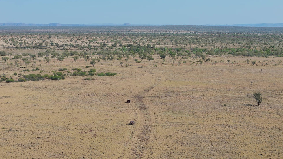
The entry was eroded and the exit was a near-vertical climb of close to a metre. That was where everyone before us had clearly decided the same thing we did, and we crawled back out the way we'd come.
Not far away was a camp we'd spotted on Wiki Camps, and it turned out to be a cracker. A wicked little spot with plenty to explore, croc spotting from the bank, and firewood everywhere. Sometimes plan B is better than plan A.


The next morning we called in at the old Ord River homestead on our way through, the first station established out this way in the East Kimberley. It's heritage listed but in a sad state of disrepair now, down to a few buildings, and we kept out of the shakiest ones. Paul did some enthusiastic renovating in his imagination, an old cook house turned into a little bar with river views. Then it was on towards the Territory border.

Crocs by torchlight on the Negri
The Negri River gave us one of the prettiest camps of the lot. We tucked ourselves away from the main camping area, a little mission to get into, definitely not somewhere you'd tow a van, but well worth the effort for how peaceful it was.

Heaps of birds, and more crocs than we could count once the torches came out after dark. There was a baby freshie right on the water's edge that let us walk up to within a few metres before it calmly slipped away.
Last night on the Behn
Our final night was on the Behn River, on Rosewood Station. It's a free camp, but you need to call ahead for permission, which we did, and they waved us in with the usual conditions: no fires, take your rubbish with you.

By this point we'd realised we'd camped on a different river every single night of this leg, and every one of them feeds into the Ord. The Behn water was clear and lovely, a little mossy in spots, with a resident freshie somewhere in there we never did get properly introduced to. A quiet last night to close out the leg.
The long way round
Six days, six camps, and a different river every night, all of them feeding into the Ord. Duncan Road gave us overgrown goat tracks and dead ends, a hidden oasis, river camps we had entirely to ourselves, campfire cooking and freshwater crocodiles by torchlight. Not every track went our way, some had locked gates and some the wet had swallowed whole, but the ones that did led to the kind of country you only find by leaving the bitumen behind. If you like venturing off the beaten path and taking what the season gives you, this stretch of the East Kimberley is hard to beat.
Watch the episode
We filmed the whole leg, from the overgrown track into the first gorge to the last night on the Behn. Watch the full episode below.
Get the GPX pack
If you want to drive any of this yourself, the GPX pack for this leg is up on our website. Every track we took, marked for what we found: which were open, which were locked, and which the wet had claimed at the time we came through. It'll save you a fair bit of the guesswork.
Free location guide
We put together a free one-page location guide for this leg, with the conditions, access notes and the lay of the land at a glance.
Karleah & Paul
Adventure Lifestyle


Comments